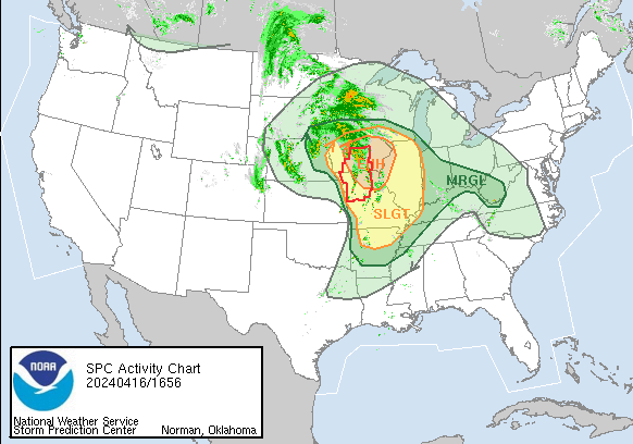
Scattered severe thunderstorms are likely today, especially across northern Missouri, Iowa, and northwestern Illinois. Large hail, damaging winds, and tornadoes are expected. More isolated activity could develop as far south as the Ozarks and Mid-South.
Midwest/Middle Mississippi Valley: Regenerative scattered showers and thunderstorms continue to occur across western/northern Missouri into much of Iowa at late morning, originating with a warm sector that narrows with north-northwestward extent into southern Iowa and far east/northeast Nebraska in vicinity of the surface low. Even while warm-sector cloud breaks have been limited, steady early-spring heating and low-level moistening is occurring with surface dewpoints rising through the lower 60s F.
