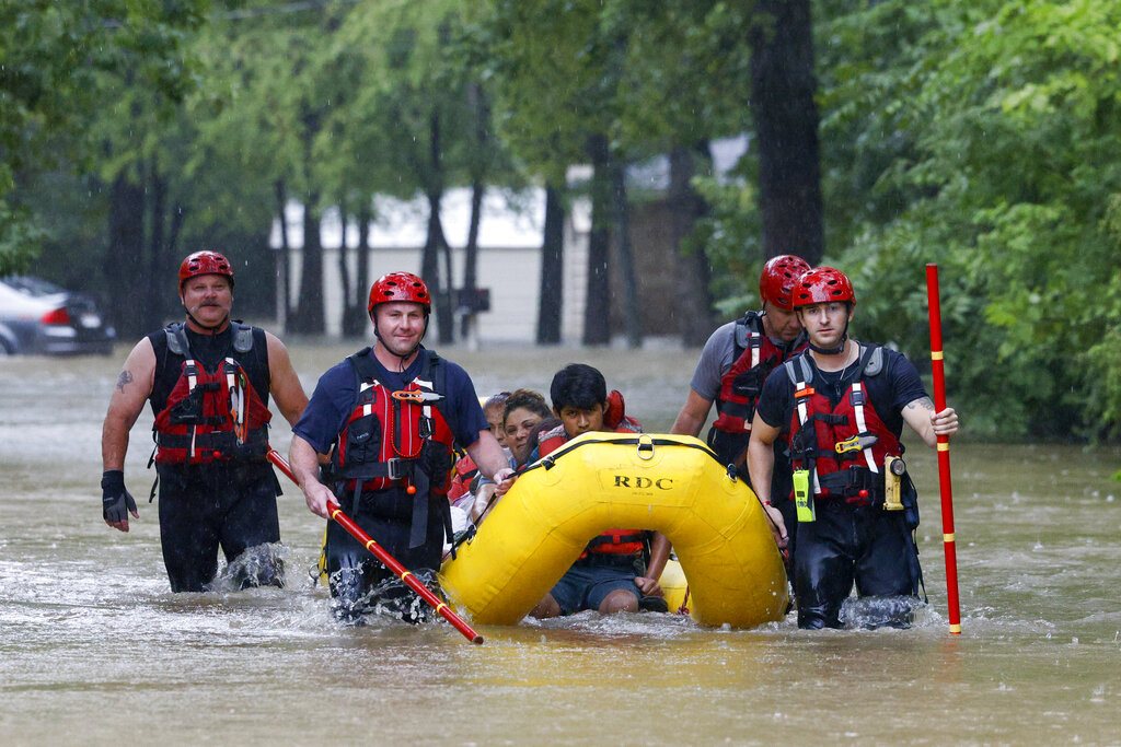
Parts of northern Texas, mired in a drought labeled as extreme and exceptional, are flooding under torrential rain. In a drought.
Sound familiar? It should. The Dallas region is just the latest drought-suffering-but-flooded locale during a summer of extreme weather whiplash. Parts of the world are lurching from drought to deluge.
The St. Louis area and 88% of Kentucky early in July were considered abnormally dry and then the skies opened up, the rain poured in biblical proportions, inch after inch, and deadly flooding devastated communities. The same thing happened in Yellowstone in June. Earlier this month, Death Valley, in a severe drought, got a near record amount of rainfall in one day, causing floods, and is still in a nasty drought.
“So we really have had a lot of whiplash,” said Kentucky’s interim climatologist Megan Schargorodski. “It is really difficult to emotionally go through all of these extremes and get through it and figure out how to be resilient through the disaster after disaster that we see.”
In just two weeks in late July and early August, the U.S. had 10 downpours that are only supposed to happen 1% of the time — sometimes called 1-in-100-year storms — calculated Weather Prediction Center forecast branch chief Greg Carbin. That’s not counting the Dallas region, a likely 1-in-1,000-year storm, where some places got more than 9 inches of rain in 24 hours ending Monday with several inches more forecast to come.
“These extremes of course are getting more extreme,” said National Center for Atmospheric Research climate scientist Gerald Meehl, who wrote some of the first studies 18 years ago about extreme weather and climate change. “This is in line with what we expected.”
Weather whiplash, “where all of a sudden it changes to the opposite’’ extreme, is becoming more noticeable because it’s so strange, said climate scientist Jennifer Francis of the Woodwell Climate Research Center in Falmouth, Massachusetts. She is in the middle of a study of whiplash events.
In the United States, many of the big heavy summer rains are traditionally connected to hurricanes or tropical systems, like last year’s Hurricane Ida that smacked Louisiana and then plowed through the South until it flooded the New York, New Jersey region with record rainfall rates.
But this July and August, the nation had been hit with “an overabundance of non-tropical related extreme rainfall,” the National Weather Service’s Carbin said. “That’s unusual.”
As the atmosphere warms it holds more water, 4% more for every degree (7% more for every degree Celsius), scientists said.
Think of the air as a giant sponge, said UCLA and Nature Conservancy climate scientist Daniel Swain. It soaks up more water from parched ground like a sponge “which is why we’re seeing worse droughts in some places,” he said. Then when a weather system travels further, juicy with that extra water, it has more to dump, causing downpours.
Another factor is the stuck and wavier jet stream — the atmospheric river that moves weather systems around the world — said Woodwell’s Francis. Storm systems don’t move and just dump huge amounts of water in some places. Other places, like China, are stuck with hot weather as cooler, wetter weather moves around them.
“When that jet stream pattern gets amplified, which is what we’re starting to see happen more often, then we notice more of these big whiplash events,” Francis said.
When the ground is so hard from drought, water doesn't seep in as much and runs off faster in flood, Francis and others said.
The United Nations' Intergovernmental Panel on Climate Change emphasized what it called compounding weather disasters as a future threat.
“Frankly how fast and how badly it’s now playing out is a surprise to many of us,” said IPCC report co-author Maarten van Aalst, director of the Red Cross Red Crescent Climate Centre in the Netherlands. “It’s scary how quickly it is appearing in front of our eyes.”