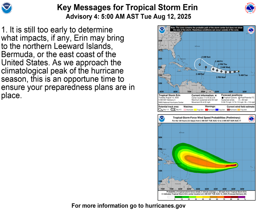
It is still too early to determine what impacts, if any, Erin may bring to the northern Leeward Islands, Bermuda, or the east coast of the United States. As we approach the climatological peak of the hurricane season, this is an opportune time to ensure your preparedness plans are in place. - Nat'l Hurricane Center
NWS National Hurricane Center Miami FL AL052025 500 AM AST Tue Aug 12 2025 The storm has not become significantly better organized on geostationary satellite imagery over the past few hours. Deep convection has diminished in intensity, as evidenced by a warming of the cloud tops. An AMSR microwave image from a few hours ago showed a well-defined banding feature over the southern semicircle of the system. Subjective Dvorak intensity estimates range from 35 to 45 kt and objective estimates from UW-CIMSS are generally near 40 kt.
Thus the advisory intensity is held at 40 kt. Erin continues its rapid westward motion, at around 265/19 kt. A strong 500 mb ridge is situated to the north of the cyclone, resulting in a strong easterly steering current. The tropical cyclone should continue on a general westward heading for the next few days with a gradual decrease in forward speed as the ridge weakens slightly. Later in the forecast period, the ridge is expected to weaken a little more, and a more west-northwestward track is likely.
The official forecast track is a little left, or south, of the previous one in 3-5 days, and very close to the latest dynamical model consensus. This also very similar to the mean of the GFS and ECMWF solutions. The spread of the track models suggest near-average confidence in the NHC forecast. During the forecast period, Erin will be traversing warmer ocean waters and the SHIPS model diagnoses low vertical wind shear over the system for the next several days. However, the model does not indicate an increase in the environmental low- to mid-tropospheric humidity during the next 72 hours or so. Nonetheless, given the low shear and increasing SSTs, strengthening is expected. The official intensity forecast is at the high end of the model guidance and shows Erin becoming a major hurricane in around 5 days. There is significant uncertainty in intensity predictions at this time range.